


UAV Zones - Drone and UAV no-fly zone maps app for iPhone and iPad
Developer: Engin Ates
First release : 03 Mar 2015
App size: 187.84 Mb
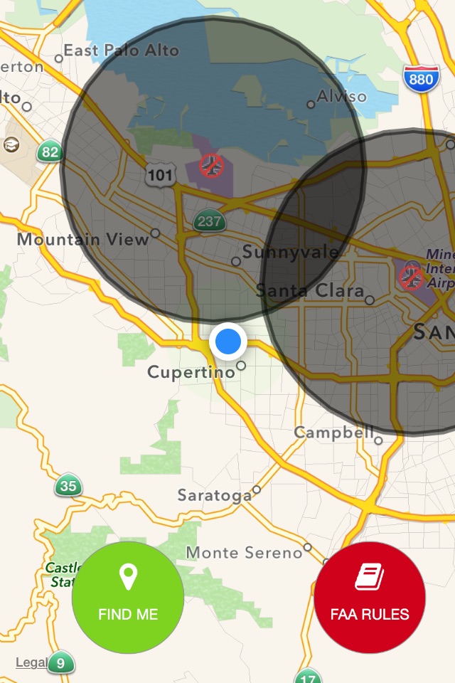
UAV Zones display most of the no-fly zones for the drones. It is based on no fly zone maps. Black polygons are represent no fly zones .
Please send us any feature request for the app.
FEATURES
- Added new airport , heliport and other type of flying object landing places
- You be able to search
- Just move map to location that you want to see and tap "Search Here"
- Added weather screen, it will show current or selected areas weather information.
- No Fly Zone Maps cover most of the US Airports, National Parks, Military bases.
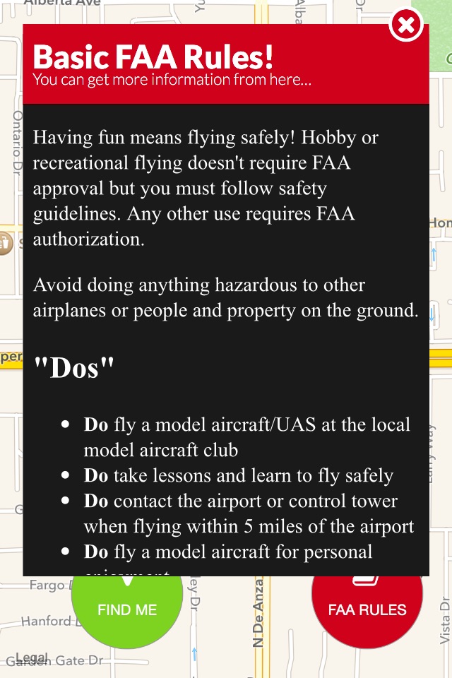
Disclaimer: We do not assume responsibility for the accuracy of the data represented in this app for the NO FLY ZONE restrictions. Please also check with FAA to make sure you can fly your UAV. If you like to do any commercial flights, please contact closest FAA bureau from 1-866-835-5322 and get a clearance. The data is gathered from public APIs.